Evansville
System Information
System Description
Water is withdrawn from an intake along the Kaskaskia River downstream of Carlyle Lake at up to 400 gpm.
Satellite Communities and Water Districts
None
Population Served: |
750 |
County: |
Randolph |
Watersheds: |
Kaskaskia |
Water Source
| Name |
Type |
Stream |
DA (sq mi) |
SA (ac) |
Capacity |
Year Est. |
Est. 2010 Cap. (ac-ft) |
| Kaskaskia River |
RW |
Kaskaskia R |
5718 |
|
|
|
|
1989 Study: |
50-year drought yield sufficient at present level of water use. |
USGS Gages: |
Kaskaskia River near Venedy Station (05594100) |
Developments since 1989:
None

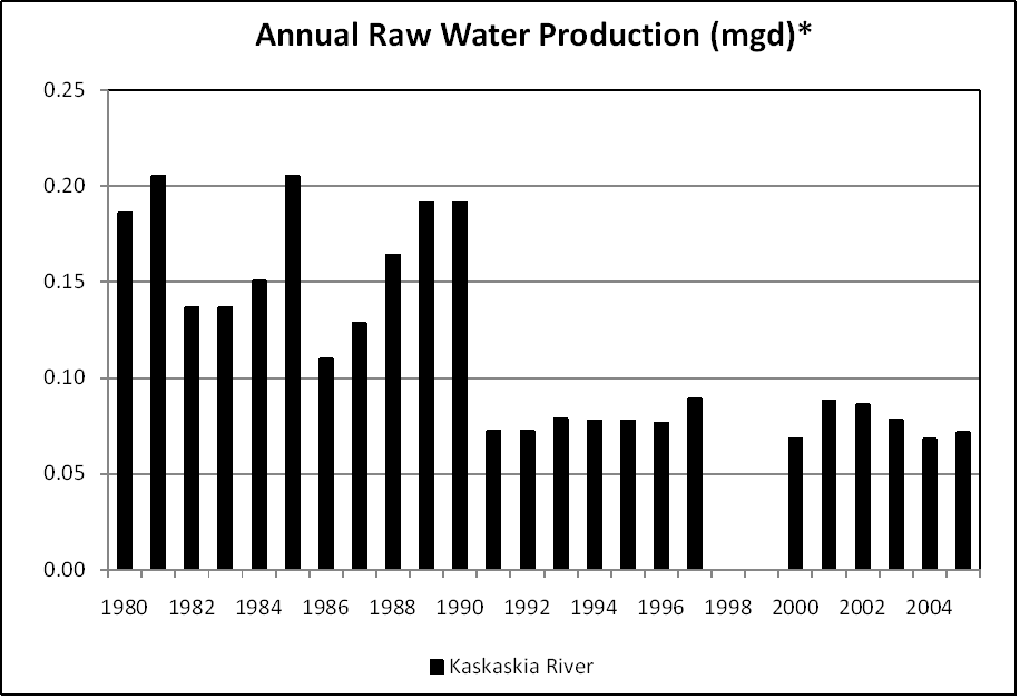
Note: *Loss of satellite community at Ellis Grove (circa 1991) reduced overall production.
Notes and Terminology
Vulnerability Report
Choose another Community

