Green River Lowlands Monitoring
The Green River Lowlands in Lee-Whiteside-Bureau counties is a heavily irrigated portion of Illinois, comprised of the uppermost Tampico Aquifer and lowermost Sankoty Aquifer. These aquifers are separated by a clay layer that becomes more extensive to the south of the Rock River. Irrigation is predominantly in the deeper Sankoty Aquifer, which experienced its largest observed drawdown during the drought of 2012 in northwestern Bureau County. To monitor the impact of irrigation in the region (as well as the potential for groundwater flooding during rainy seasons), the ISWS currently has nine real-time monitoring stations in the region, with periodic hand-measurements at multiple other wells. For more details on the hydrogeology of the region, see ISWS Data/Case Study 2004-01.
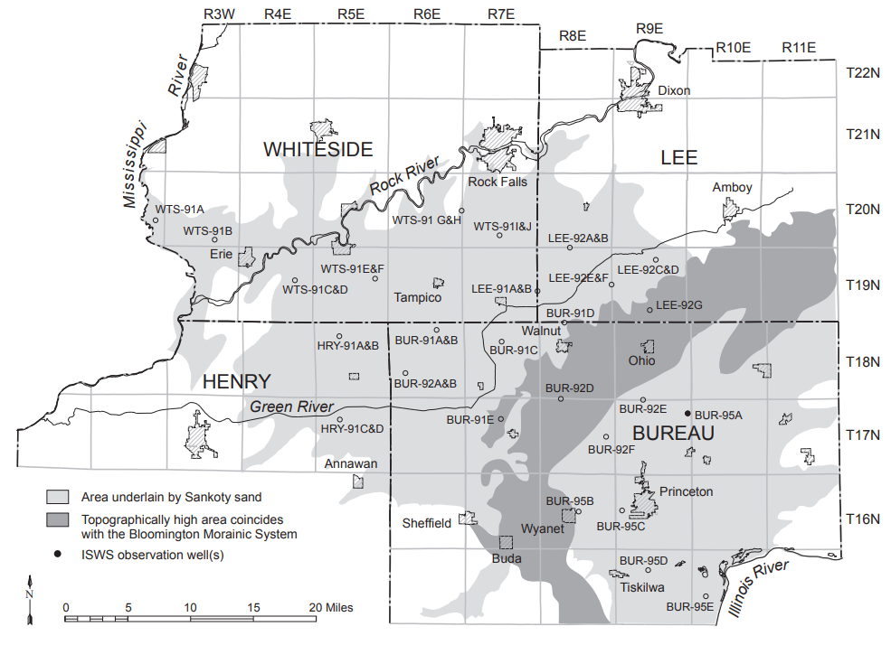
The map to the right shows the location of the monitoring wells in the Green River Lowlands area. For sites with telemetry, real-time data can be viewed by clicking on the corresponding well listed below.
Real-Time Monitoring Wells
Sankoty
Tampico

