Principal Investigators: William P. White
Project Staff: John Beardsley, Jon Rodsater, Long Duong
Sponsor: Illinois State Water Survey (ISWS), Illinois Environmental Protection Agency (IEPA), Illinois Department of Natural Resources (IDNR), Illinois Army National Guard Marseilles Training Center (IANGMTC), and ComEd
Project Period: IEPA support September 2010 - July 2011, ISWS, IDNR, and IANGMTC support 2009-2019, and ComEd 2011 support.

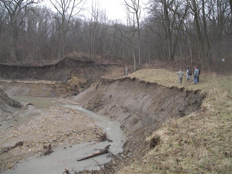
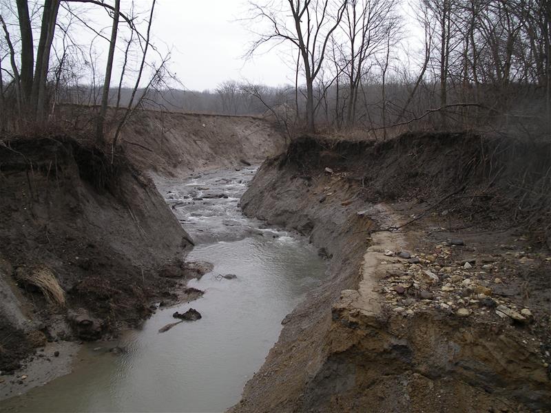
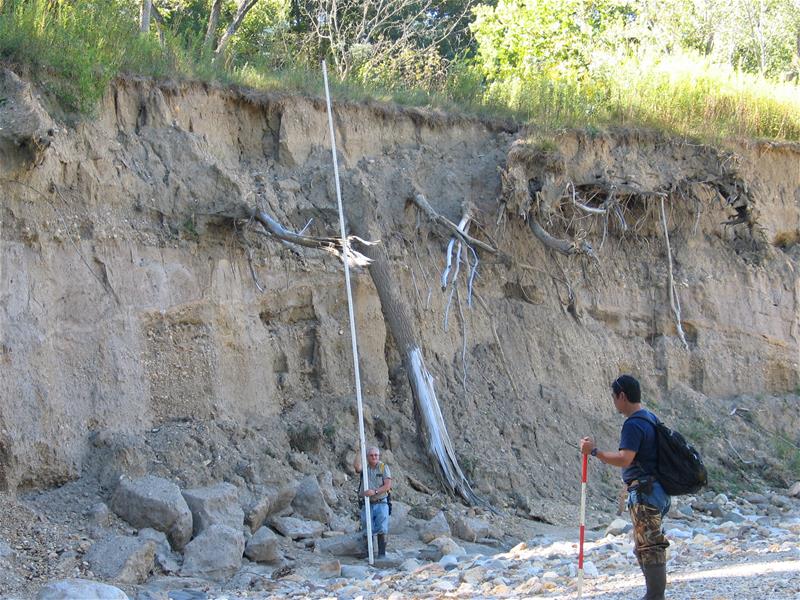
South Kickapoo Creek is located in La Salle County, Illinois near Marseilles and meanders through Marseilles State Fish & Wildlife Area. The watershed is 4,769 acres at 7.5 square miles excluding Lake La Salle. South Kickapoo Creek is a bluff ravine system of the upper Illinois River valley that is severely eroding. Inspection of the site revealed a massive nickpoint caused by a breach in a man-made dike around a deep abandoned gravel pit. The stream had been perched above the gravel pit at an estimated height of 30 to 50 feet. It was estimated that the headcutting process rapidly cut into the existing streambed by over 9 feet and migrated 1800 feet upstream depositing sediment and streambed material into the now adjoining lake. Streambed materials are also being transported downstream plugging the outflow culverts of the lake at a downstream crossing and causing the road to flood. Pool and Riffle grade control design were utilized and installed to address the breach area and advancing nickpoints. Geomorphic and habitat assessments were conducted to document stream channel adjustments in the critically affected area and to evaluate stream channel conditions throughout the watershed.

Findings to Date:
Initial geomorphologic and habitat assessment information indicate that unstable and critically unstable stream channel segments exist in the majority of the assessment area. The assessment clarifies the need to target in-channel restoration and watershed resource management in much of the assessed area. A stream channel profile survey found that headcutting had migrated 1800 feet upstream from the gravel pit resulting in an excessive channel slope of two percent. It was determined that the headcutting process was progressing rapidly toward a ComEd transmission tower near the channel threatening to undermine the structure.
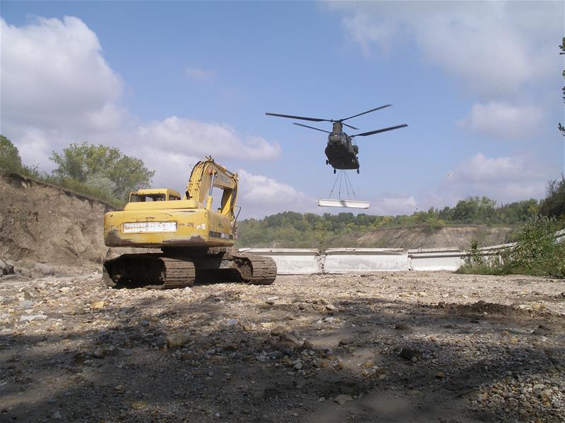
A series of 14 Pool and Riffle structures were installed during 2011 and 2012 to slow the incision throughout the affected stream channel reach. Severe flooding during 2013 damaged four of the Pool and Riffle structures that were in the steep stream channel slope near the gravel pit. The ISWS has photo documented the stream channel and project conditions from 2009 to 2018 to provide available information when the stream is addressed in the future. The ISWS has also documented headcutting in the adjoining tributary SKC where nickpoints have been migrating in that channel since the 2006 breach.

Project Documents/Publications:
Beardsley J., 2018, Draft, Illustrated Evolution of a Stream Reach of South Kickapoo Creek, Illinois State Water Survey, Prairie Research Institute, University of Illinois, Champaign-Urbana, Illinois.
Beardsley, J., L. Keefer 2018, Draft, Progress Report: Comparison of Multiple Pool and Riffle Assessments for South Kickapoo Creek, Marseilles State Fish and Wildlife Area, prepared for Illinois Department of Natural Resources, Springfield, Illinois, Illinois State Water Survey, Prairie Research Institute, University of Illinois, Champaign-Urbana, Illinois.
Beardsley, J., L. Keefer 2017, Poster, Extreme Headcutting and Stream Restoration Efforts in South Kickapoo Creek, Illinois State Water Survey, Prairie Research Institute, University of Illinois, Champaign-Urbana, Illinois.
White, W. P., J. Beardsley, 2011, South Kickapoo Creek Restoration Project and Addendum Geomorphic and In-stream Habitat Assessment of South Kickapoo Creek, prepared for Illinois Environmental Protection Agency, Springfield, Illinois. Illinois State Water Survey, Prairie Research Institute, University of Illinois, Champaign-Urbana, Illinois.
White, W. P., J. Beardsley, 2009, Draft, South Kickapoo Creek at Marseilles Fish and Wildlife Area, Prepared for the Illinois Department of Natural Resources Office of Resource Conservation, Illinois State Water Survey, Institute of Natural Resource Sustainability, University of Illinois, Champaign-Urbana, Illinois.
Related Publications:
Kropp Cathy, 2012, Strong Partnership Saves Kickapoo Creek, United States Army Environmental Command, Fort Sam Houston, San Antonio, Texas.
Tecic D., 2011, Physics and the Wildlife Action Plan, OutdoorIllinois, Vol. 19, No. 10, October, 2011, Illinois Department of Natural Resources, Springfield, Illinois.
