Principal Investigators John Beardsley, Laura Keefer
Project Staff:
Primary contributors: John Beardsley, Long Duong, Marc Gaboury, Thomas Hill, Rob Hilsabeck, Laura Keefer, Dr. Robert Newbury, Jon Rodsater, Don Roseboom, and Rick Twait.
Other contributors: Erin Bauer, Phil Bradshaw, Diana Day, Linda Dexter, Rick Johnson, Alan Kirwan, Billy Kocher, John Lesnak, Rod McCoy, Richard Offenback, Steve Pescitelli, Greg Saline, Steve Staats, Lara Seek, Randy Sauer, Randy Stowe, Joy Telford, Scott Tomkins, Mike Trigg, Bill White, Steve Wikner and others.
Agency Sponsors and or Contributors:
Illinois State Water Survey, Illinois Department of Natural Resources, Illinois Environmental Protection Agency, United States Environmental Protection Agency, United States Corps of Engineers, City of Waukegan, Illinois, Johnson County, Kansas, Dupage County, Illinois, United States Fish and Wildlife, Fox Waterway Agency, Newbury Hydraulics and others.
Project Period: early 1980’s – Present
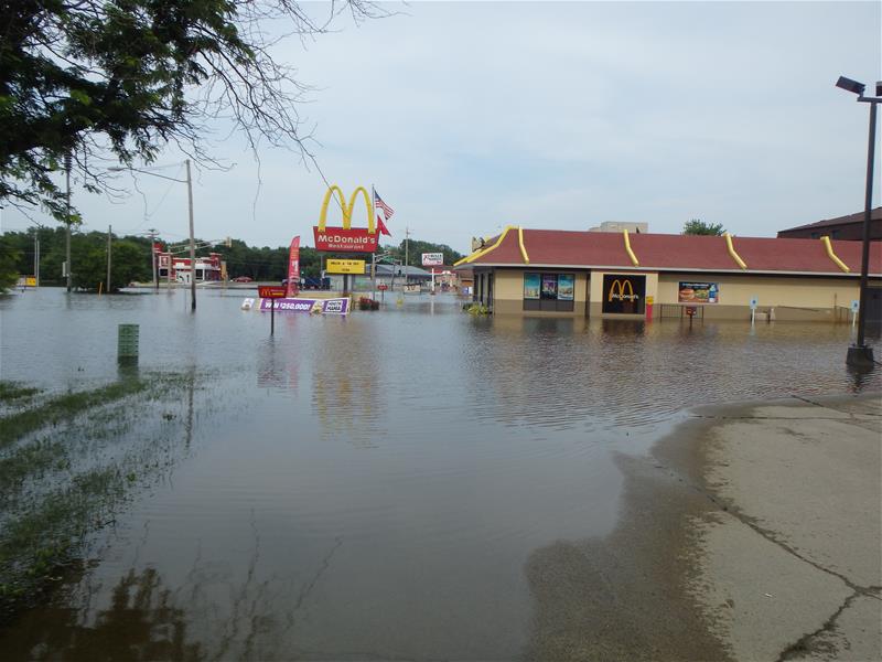
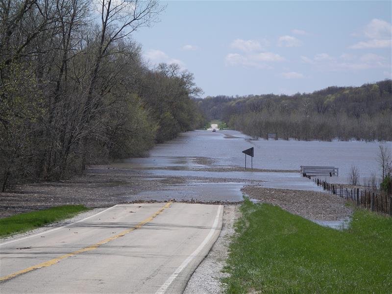
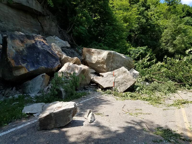
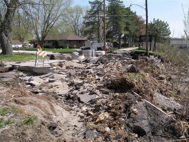
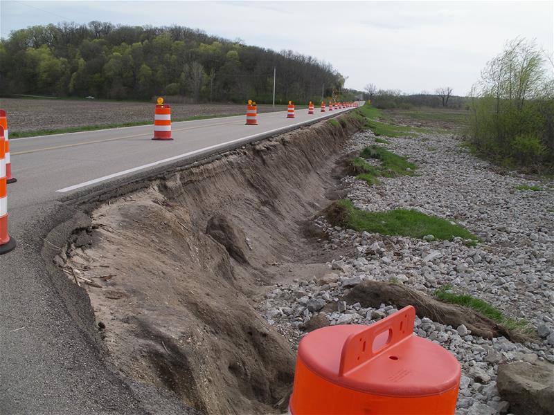
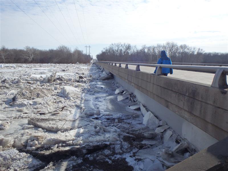
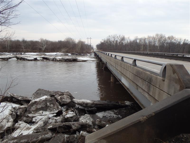
Since the early 1980’s the SWAR program (formerly Nonpoint Pollution program) has been video and photo documenting its projects and river and stream conditions including conditions that have an impact on people and infrastructure. In 2004, 2005, 2007, 2008, and 2011 SWAR conducted aerial flyovers as part of geomorphic assessments of the Illinois River basin covering 1,750 miles of rivers and streams using a helicopter and RED Hen system. This system embeds GPS coordinates into digital videos allowing documented features to be located on maps with greater efficiency. To date SWAR’s collection is estimated to consist of several thousand photos and over 400 hours of video.
Findings to Date:
Video and photo documentation has been a valuable resource for projects, workshops, outreach, and as a historical reference.
Project Documents/Publications:
Beardsley J., 2018, Draft, The Story of a Dike at Emiquon, Illinois State Water Survey, Prairie Research Institute, University of Illinois, Champaign-Urbana, Illinois.
Video Productions:
Several videos were produced by SWAR for workshops, outreach, and as project deliverables:
Updated remake of The Waukegan River National Monitoring Program, 2006
Updated remake of Lake Pittsfield National Watershed Monitoring Project, 2005
Constructing Pools and Riffles for Stream Rehabilitation, 1998
Streambank Erosion Control Techniques Manual, 1998
The Waukegan River National Monitoring Program, 1997
Watershed Causes of Channel Erosion, 1996
Lake Pittsfield National Watershed Monitoring Project, 1994
Middle Fork of the Vermilion Stream Restoration Project, 1994
Stream Habitat Enhancement, 1994
Watershed Restoration in Siloam Springs State Park, 1994
Non-Point Pollution Control in Urban Streams, 1993
Revegetation of Illinois River System: Floating Island Revegetation Technique, 1992
Willow Post Streambank Stabilization Techniques, 1992
Richland Creek Cedar Tree Stabilization Method, 1991
Crow Creek stabilization, 1991
1991 Governor’s Conference on the Management of the Illinois River System
Video Flyovers:
Rivers and Streams Video Documented| Illinois River and Sub-Basins Spring 2004 | Miles (km) of Aerial Reconnaissance |
| Ackerman Creek | 6.83 (11.00 km) |
| Blue Creek | 7.04 (11.33 km) |
| Farm Creek | 21.19 (34.10 km) |
| Partridge Creek | 15.77 (25.39 km) |
| Mundinger Creek | 3.10 (4.99 km) |
| Tenmile Creek | 7.62 (12.26 km) |
| Spring Creek | 4.00 (6.44 km) |
| Senachwine Creek | 32.80 (52.79 km) |
| Peoria Lake | |
| Lacon to Downtown Peoria | 27.50 (44.26 km) |
| La Moine River Watershed | |
| Camp Creek | 29.30 (47.15 km) |
| East Fork La Moine River | 52.00 (83.69 km) |
| Drowning Fork | 18.00 (28.97 km) |
| Grindstone Creek | 18.40 (29.61 km) |
| Des Plaines River Watershed | |
| Hickory Creek | 5.40 (8.69 km) |
| Vermilion River Watershed | |
| Little Vermilion River | 40.10 (64.53 km) |
| Kankakee River Watershed | |
| Kankakee River (IL, IN) | 119.00 (191.51 km) |
| Baker Creek | 12.00 (19.31 km) |
| Exline Slough | 11.00 (17.70 km) |
| Rock Creek | 30.50 (49.08 km) |
| Trim Creek | 23.00 (37.01 km) |
| Iroquois River Watershed | |
| Iroquois River (IL, IN) | 40.40 (65.02 km) |
| Beaver Creek (IL, IN) | 27.50 (44.26 km) |
| Langan Creek | 27.50 (44.26 km) |
| Pike Creek | 25.50 (41.04 km) |
| Indiana | |
| Yellow River | 63.20 (101.71 km) |
| Spoon River Watershed Fall 2005 | Miles (km) of Aerial Reconnaissance |
| Spoon River | 146.50 (235.77 km) |
| Barker Creek | 5.80 (9.33 km) |
| Coal Creek | 14.50 (23.34 km) |
| East Fork Spoon River | 12.70 (20.44 km) |
| Francis Creek | 4.00 (6.44 km) |
| Indian Creek | 24.40 39.27 km) |
| Littlers Creek | 12.80 (20.60 km) |
| Shaw Creek | 7.00 (11.27 km) |
| Snake Den Hollow | 5.50 (8.85 km) |
| Stuart Creek | 7.30 (11.75 km) |
| Tater Creek | 12.60 (20.28 km) |
| Walnut Creek | 32.70 (81.1 km) |
| West Fork Spoon River | 10.60 (17.06 km) |
| Cedar Creek | 25.30 (40.72 km) |
| Big Negro Creek | 8.80 (14.16 km) |
| Italian Slough/Indian Creek | 8.10 (13.04 km) |
| Little Negro Creek | 6.40 (10.30 km) |
| Little Swan Creek | 7.24 (11.65 km) |
| Negro Creek | 2.30 (3.70 km) |
| Picayune Creek and Tributaries | 38.70 (95.11 km) |
| Slug Run/Cedar Fork | 13.80 (22.21 km) |
| Swan Creek | 15.20 (24.46 km) |
| Court Creek | 7.00 (11.27 km) |
| Middle Creek | 7.50 (12.07 km) |
| North Creek | 3.50 (5.63 km) |
| Haw Creek | 22.25 (35.81 km) |
| Brush Creek | 18.60 (36.37 km) |
| Hermon Creek | 7.60 (12.23 km) |
| Lake Bracken | 1.80 92.90 km) |
| French Creek | 17.50 (28.16 km) |
| Swab Run | 10.30 (16.58 km) |
| Put Creek | 10.00 (16.09 km) |
| Laswell Branch | 5.20 (8.37 km) |
| Lost Grove Creek | 6.70 (10.78 km) |
| Turkey Creek | 11.00 (17.70 km) |
| Big Creek | 28.60 (46.03 km) |
| Slug Run | 3.20 (5.15 KM) |
| Crow Creek West Watershed | |
| Crow Creek West | 27.50 (44.26 km) |
| Scholes Branch | 8.70 (14.00 km) |
| North West Branch | 4.10 (6.60 km) |
Spoon River Watershed Winter 2007 | Miles (km) of Aerial Reconnaissance |
| Spoon River | 41.54 (65.98 km) |
| CREP | 6.36 (10.24 km) |
| Haw Creek | 5.00 (8.05 km) |
| Camp Run | 11.00 (17.70 km) |
| Cedar Creek | 27.00 (43.45 km) |
| Cedar Creek Tributary | 1.83 (2.95 km) |
| Picayune Creek | 17.00 (27.36 km) |
| Picayune Creek Tributary | 4.08 (1.61 km) |
| Negro Creek | 9.00 (14.48 km) |
| Little Negro Creek | 5.00 (8.05 km) |
| Big Negro Creek | 11.00 (17.70 km) |
| Cedar Fork | 11.40 (16.09 km) |
| Latimer Creek | 6.00 (9.66 km) |
| Slug Run | 4.00 (6.44 km) |
| Indian Creek | 3.00 (4.83 km) |
| Swan Creek | 27.40 (44.10 km) |
| Swan Creek Tributary | 2.90 (4.67 km) |
| Crow Creek West Watershed | |
| Crow Creek West | 31.34 (50.44 km) |
| Crow Creek West Tributary | 4.00 (6.44 km) |
| Scholes Branch | 7.00 (11.27 km) |
| Big Bureau Creek Watershed Spring 2008 | Miles (km) of Aerial Reconnaissance |
| Big Bureau Creek | 85.23 (137.16 km) |
| East Bureau Creek | 16.02 (25.78 km) |
| Epperson Run | 7.06 (11.36 km) |
| Lime Creek | 10.59 (17.04 km) |
| Masters Fork | 18.83 (30.31 km) |
| Pike Creek | 21.21 (34.13 km) |
| Pond Creek | 10.33 (16.62 km) |
| Rocky Run | 6.18 (9.94 km) |
| West Bureau Creek | 23.73 (38.20 km) |
| South Kickapoo Creek Watershed Spring 2011 | Miles (km) of Aerial Reconnaissance |
| South Kickapoo Creek | 8.40 (13.52 km) |
| South Kickapoo Tributary A | 1.20 (1.93 km) |
| South Kickapoo Tributary AA | 1.10 (1.77 km) |
| South Kickapoo Tributary B | 0.90 (1.45 km) |
| South Kickapoo Tributary C | 2.20 (3.54 km) |
| South Kickapoo Tributary D | 0.90 (1.45 km) |
| South Kickapoo Tributary E | 1.70 (2.74 km) |
| South Kickapoo Tributary EA | 0.90 (1.45 km) |
| South Kickapoo Tributary F | 1.40 (2.25 km) |
| South Kickapoo Tributary G | 0.80 (1.29 km) |
| South Kickapoo Tributary GA | 0.70 (1.13 km) |
| South Kickapoo Tributary H | 0.80 (1.29 km) |
| South Kickapoo Tributary I | 0.60 (0.97 km) |
| South Kickapoo Tributary J | 1.00 (1.61 km) |
Related Projects and Publications:
Numerous publications have utilized SWAR photos,
Geomorphic and In-Channel Habitat Assessment of South Kickapoo Creek at Marseilles
Prairie Creek (LaMoine River Watershed) and Indian Creek and Italian Slough (Spoon River Watershed)
Illinois River Watershed & Pool Assessments and Computerized Inventory and Database System
Installation of Newbury Riffles in the Cache River to Stabilize the Streambed and Enhance Habitat
National Monitoring for Instream Habitat and Urban Fisheries in the Waukegan River
Data:
Pictures on this page are example of information collected
Contact:
| John Beardsley |
| Illinois State Water Survey |
| Prairie Research Institute |
| University of Illinois Urbana-Champaign |
| Illinois Central College |
| 1 College Dr, Room 340G |
| East Peoria, Illinois, 61635-0001 |
| Office: (217 300-3474 |
| Cell: (309) 299-5680 |
| Email: jbeardsl@illinois.edu |
